

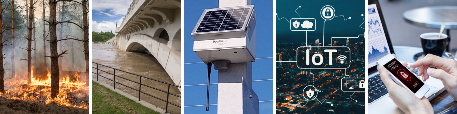
It is summer in the northern hemisphere, and what a summer it has been so far. Once again, wildfires are ravaging through the American and Canadian West, and Southern Europe. The Dixie fire in California is now the state’s second-largest wildfire in history. In Canada, fires have destroyed 13’000 square miles from British Columbia to Ontario. Firefighters in Turkey, Italy and Greece are battling violent blazes across the region. Germany, Belgium and Luxemburg have seen 120 souls perish in record flooding in July.
The two main strategies to mitigate risks in regard to natural hazards are prevention and rapid response. Fire risk prevention includes forest and vegetation management in clearance areas, and smart maintenance of power infrastructure assets. Rapid response is the capability to react in real-time with appropriate resources and coordination to changes in environmental conditions, and the propagation of hazards such as developing wildfires. Both strategies complement each other, and what they have in common is that they require vast amounts of data, processing, analytics and delivery, which are particularly challenging to generate in remote areas where cellular signal might be scarce or non-existent.
In short, what is needed is a technology that not only generates data even in remote areas without cellular coverage and no local access to power, but even analyzes and provides the data in real time in the form of alerts and actionable reports, i.e. answers to the right questions. What are current temperature levels, rain fall, wind speeds and -directions on a detailed and granular local level? Where is fire and smoke present, and in which direction does it move? Can we get eyes on the ground and see what is happening in the field without deploying crews? Might there be vegetation encroachment in clearance areas where we have not been able to identify it? What are river flow levels, and how are they changing? The answers to these questions are exactly what Hayden Data’s technology provides, in near-real time and without the need for power or communications.
Our technology is ever-evolving, and recently we have been approached by a city council in NSW, Australia. Understanding that our “magic sensor box” can measure a multitude of environmental aspects, they shared that their region suffers from two antagonistic yet severe weather phenomena, fire and flood, where remoteness, great distances, and lack of communication and power infrastructure has made it difficult to find an environmental monitoring solution that can be integrated with existing civil protection alarm services to help protect life and property.
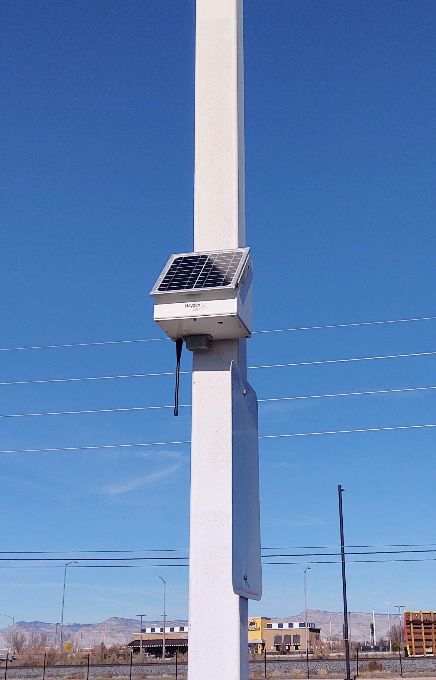
Since measuring and monitoring in remote areas, processing data and creating actionable reports and alerts is what we do best, we developed a solution for their problem, by adding an external flow sensor to our systems, integrating it with the existing possibility to monitor rainfall and detect fire and smoke. Hayden Data now have a complete end-to-end solution that combines both smoke and rainfall detection in combination with river flow rate to assist councils and emergency services dealing with wildfires and flooding that impact communities. The ideal tool to assist emergency management in near real time.
The need for a technological solution of this sort is not entirely new. From the report into the NSW Bushfire Enquiry released in July 2020, there are two paragraphs that stand out within the executive summary:
“There is also a need for improved telecommunications, both to ensure the community can access the information it needs to make timely and appropriate decisions, and to enhance fire fighting capability. This varies from improving power backup arrangements, to expanding fire information apps, to improving firefighter access to radio public safety networks. When evacuations are required, there are more things we can do to ensure that the community, especially the more vulnerable, are appropriately looked after.
Over the longer term, some major changes are needed. We need to push available technologies harder, especially fire science, remote sensing, data science and artificial intelligence to equip us better to understand what happens during a bush fire and respond more quickly. Many government systems also need to be improved, especially strengthening cross-agency accountability and governance; training; being more strategic in our land use planning to account for bush fire; and better managing critical infrastructure including fire trails and roads to minimise property and asset damage.”
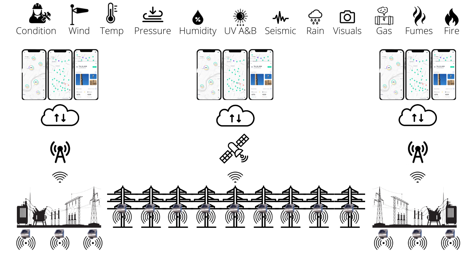
Whilst this report focused on the bushfire events of 2019-2020, there are also similar requirements associated with flood events that require the same focus on communications, technology and where possible, a single solution. Hayden Data targets both of these, and more, all packaged in our latest devices and our interactive user interface. Whilst our devices were originally built for the power utility providers, it did not take us long to discover other uses. Apart from determining the integrity and stability of an asset, monitor its behavior and possible changes in structural health, we also measure wind speed & direction, rain fall, smoke & gas levels, pressure, humidity and temperature. This combined group of sensors visually displayed on our UI enable councils, power utilities and emergency services to understand exactly what is going on during a bushfire or flood incident in near-real time, even if they are occurring at the same time.
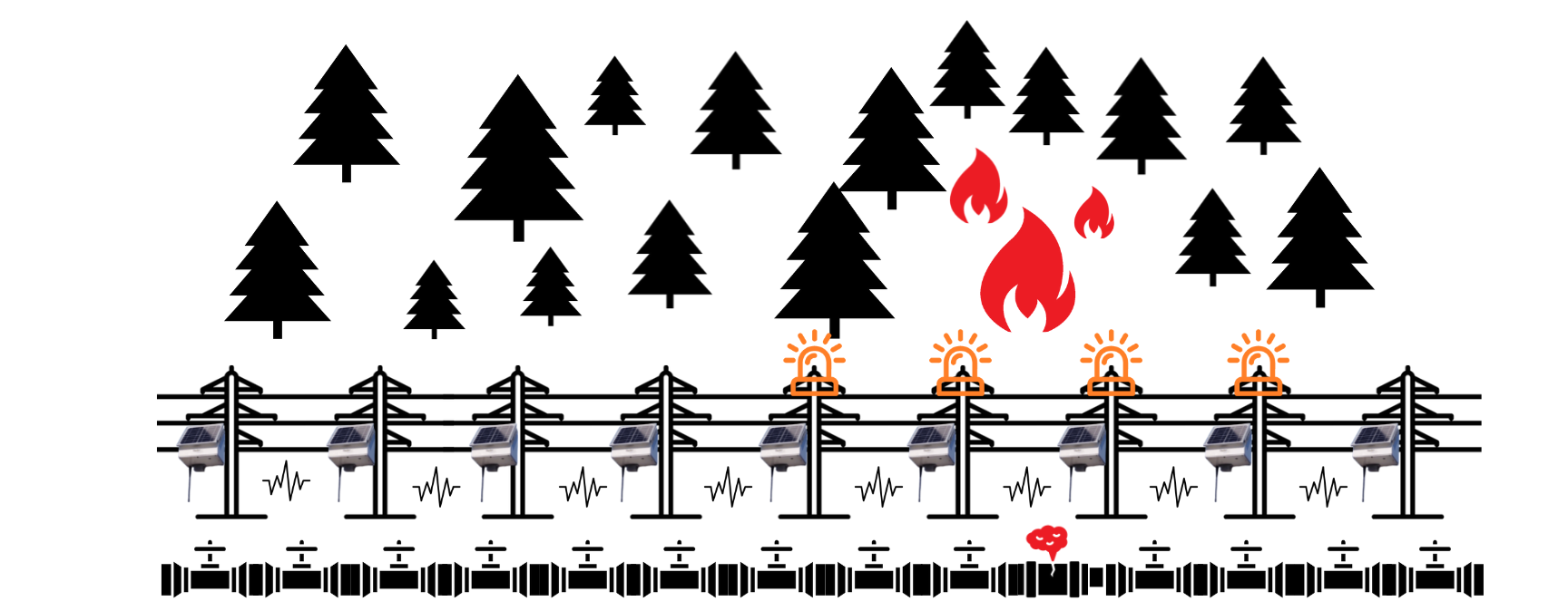
As our devices communicate on a mesh network, we are able to deploy our sensors from our gateways into areas where no signal exists. Our devices also have cameras, and images are able to be relayed to the UI through our network.
The technology is commercially available for use by power utilities, civil protection agencies, local governments and communities. Reach out to us today and schedule a consultation with our specialists!